
 A Canadian entrepreneur developed an innovative technology that is already being used in some mineral exploration camps in the Yukon territory, in the north of the country.
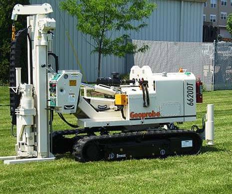
The device is called Geoprobe and is basically a small, track-mounted hydraulic drill that gathers soil and rock-chip samples from the soil-bedrock interface on an exploration property. It does almost the same thing as a trench sampling program, but in a simpler and quicker way, without scarring the surface with an excavator.
Geoprobe can thank its existence to Tao Henderson, who worked on the device for the past two years and launched it earlier this year, with the support of the Yukon gold prospector Shawn Ryan. Henderson told the website Mining News that:
We had a prototype last year that worked pretty well, but we wanted to have low impact on the environment, while capturing bedrock samples.
The entrepreneur, co-owner of the company Groundtruth Exploration, created the Geoprobe using pieces of other equipment. The device was mounted on tracks and has an RC wireless communication system that eliminates the need of an operator on the spot.
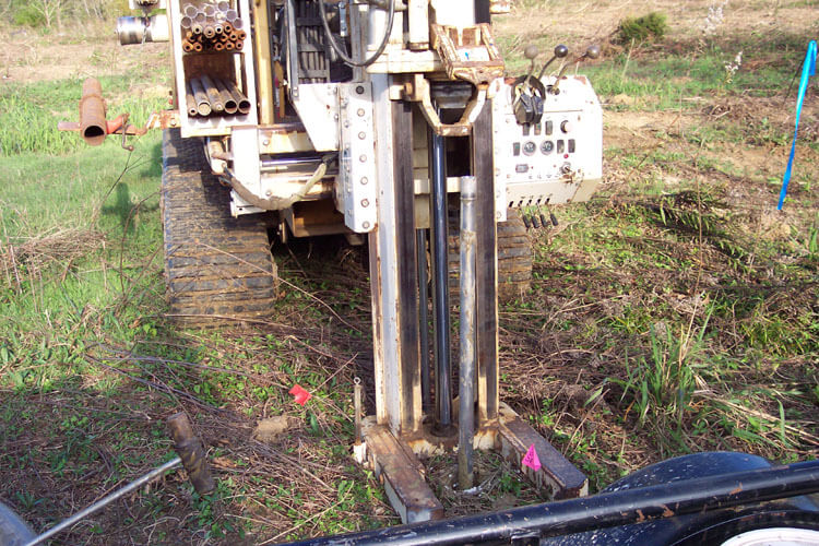 After it was ready, the device operated all summer in the Yukon territory mines along with other early-stage mineral exploration services. The machine can drill holes with 2.5 meters and collect up to 30 samples per day at five-meter spacing. Besides, it can be transported to more remote locations with a helicopter and two sling loads.
Tao Henderson added that:
It’s extremely low impact with less than one [pound-per-square-inch] ground pressure, and it’s enabled us to capture samples of the bedrock interface. We’ve gotten fantastic samples, and we can hardly tell where we’ve drilled.
Now, the entrepreneur is looking to build his second Geoprobe during this winter. The device will take some time to be finished, but after that it will pay for itself, like the first one did.
According to Henderson, his company is now focusing on building a package of services that will include an aerial system called The Drone, which is used to create digital elevation photographs, hand-soil sampling and also induced polarization surveys.