Table of Contents
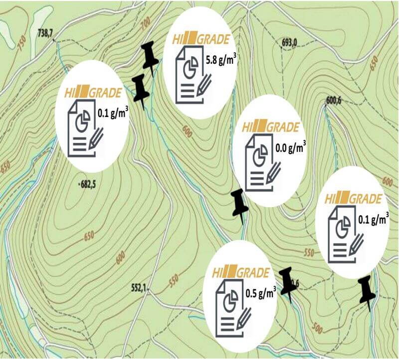
HiGrade DPI is a novel analysis method for placer gold that relies on the distinct color of gold. Analyse surface or drill samples from a placer claim . Determine the gold grade and properties. Produce instant printable reports for each sampling location of the claim.
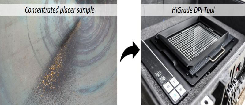
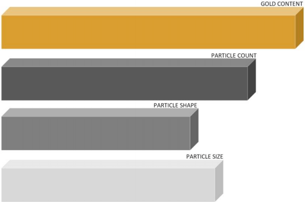
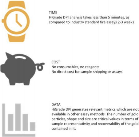
The pan concentrate is placed on a specially designed sample holder from where a high resolution image is created with an optical scanner. Then the automatic HiGrade DPI particle analyzer detects gold particles based on their golden color and calculates the gold grade of the sample. The automatically generated report includes unique statistics on the particle size distribution and particle shape. The analysis takes less than 5 min, requires no consumables and is non-destructive.
HiGrade offers a comprehensive tool kit for industrial and scientific applications, including dedicated prospectors, mineral laboratories, exploration firms and placer operations.
Exploration of Alluvial/Eluvial Gold Deposits
The topic of this short information is the exploration of deposits of not consolidated (loose) gold bearing material with free gold, which is not enclosed in rock particles. Gold in hard rock (primary gold) has to be liberated by crushing and milling and is not topic of this information.
There are two types of not consolidated gold deposits:
Eluvial Deposits
These deposits occur in close proximity to the primary deposit (mainly gold bearing quartz veins). In flat terrain, they are as loose material around or just above the quartz veins and in sloping terrain they can also lie on a slope and at the foot of a mountain, where gold-bearing quartz veins are situated. The thickness of the material is often only a few decimeters to less than one meter. At a foot of a mountain, the material can pile up to several meters.
Eluvial deposits are characterized in the way that
- the material (quartz pebbles, host rock pebbles) is sharp-edged and not or only slightly rounded
- the material usually contains a lot of fine dust
- the material is not or only slightly layered
- the material contains little heavy minerals (black sand)
- the gold content begins on the surface and changes little down
- the gold is sharp edged, irregular, and is often grown together with some quartz
- the particle size distribution is wide (from very fine gold to sometimes large nuggets)
If there was no mechanical transport of the material e.g. by a seasonal river, the grade of the material is decreasing sharply with increasing distance from the primary deposit.
Such material can therefore be found directly above, below and in the close vicinity of the gold-bearing quartz veins. Often the quartz chunks contain ingrown gold, which can be recovered after grinding. The grade of the quartz rock has to be tested by fire assay.
Alluvial Deposits
These deposits were formed and deposited by ancient, actual or temporarily active rivers. They can often extend many kilometers away from the primary deposit.
Alluvial deposits are characterized in that
- The material is more or less well rounded (gravel)
- the material occurs in layers (finer material/sand/small gravel above, coarse material (large gravel, boulders below). There also exist intermediate coarse material layers, often with gold
- the gold mostly starts only at a certain depth, there is often a barren or poor overburden, which requires removal without washing
- there is a large quantity of heavy minerals (black sand)
- the gold is smooth, rounded or flat
- the particle size distribution of the gold gets more uniform and narrow with more distance from the source
- by the action of the water, the gold is washed into the cracks and crevices of the underlying bedrock. It is therefore necessary to dig into the bedrock, at least, if possible, about 30-50 cm and wash this material. If there are cracks in hard bedrock like granite they may be cleaned manual (i.e. by dredge)
The gold grade of alluvial material can be constant over many kilometers from the primary source, but the gold gets finer and flatter with distance. Both deposit types (alluvial and eluvial) can also be mixed if, for example, eluvial material has slid down to an alluvial deposit.
Exploration Objectives
- Determine the reserves (gold grades and quantities of material)
- Map the deposit to provide data for mine planning
layers (depths and thickness of overburden and gold bearing layers, slopes, etc.)
barren areas (for waste dumps, water ponds, etc.)
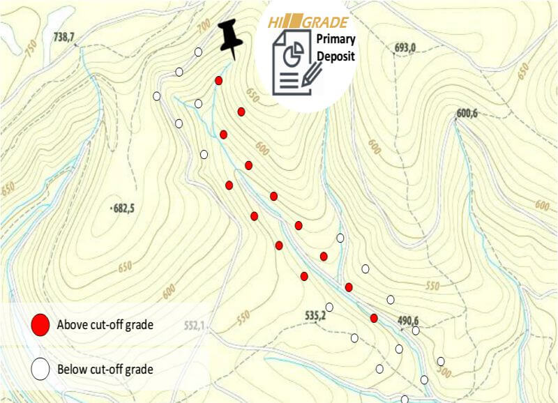
Mapping data based on gold grade and particle size/shape can be determined with the HiGrade DPI tool – www.higrade.tech - Determine the duration of the project
- Calculate the profitability of the project
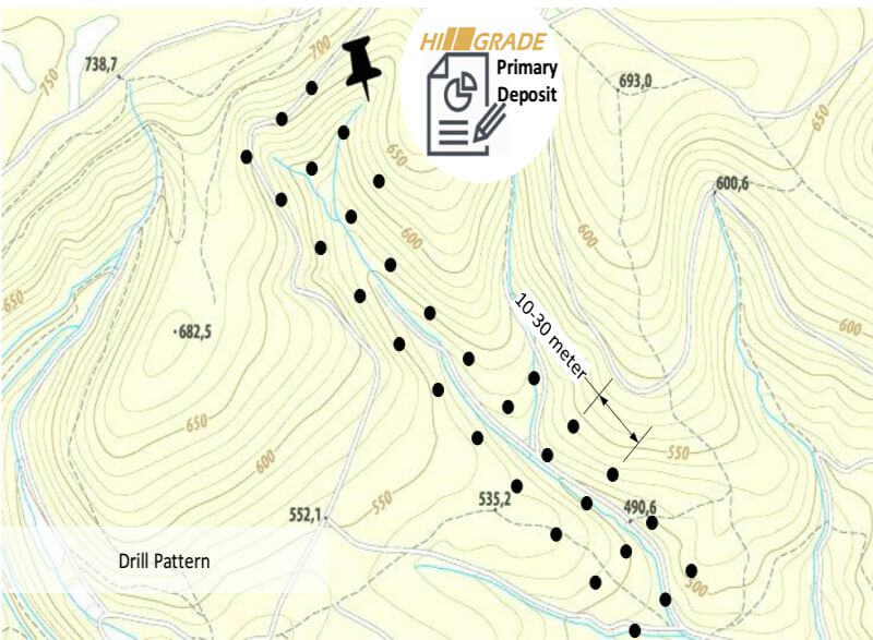
The exploration of a very large area is expensive and takes a long time. One can, for example, explore the entire deposit with 500 m distance between the lines, and decrease the line spacing, for example, to 250 m or less for detailed production planning. The more irregular the deposit is, the more narrow the grid has to be (e.g. 30 m or even 10 m distance between holes).
For shallow deposits (i.e. a few meters depth), manual pits or pits using an excavator can be used to extract samples. If the material layer is deeper than about 5-6 m, one can think about using a mechanized auger or percussion drill with casing.
Typical section of the valley (alluvial deposit), here: barren overburden and deep gold-bearing layer (“pay dirt”) with rich old channel
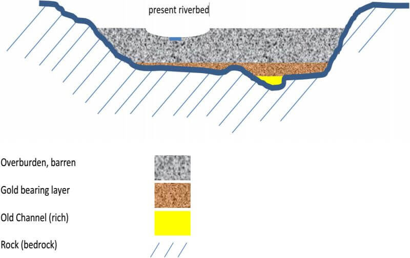
If the material is layered, it is necessary to sample the various pits layer per layer in order to determine the thickness of the barren overburden which has to be removed without washing and to determine the thickness of the gold bearing layer(s). It is therefore necessary to note for all pits the overall depth from surface to bedrock, the thickness of the barren overburden and the thickness of the gold bearing material.
Example
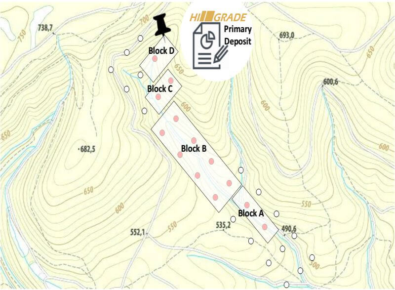
A) Sampling drill-holes or pits (distance between pits 30 m)
With additional sample pits in eluvial material close to the veins and down the slope
Mapping The Grades
Production Planning
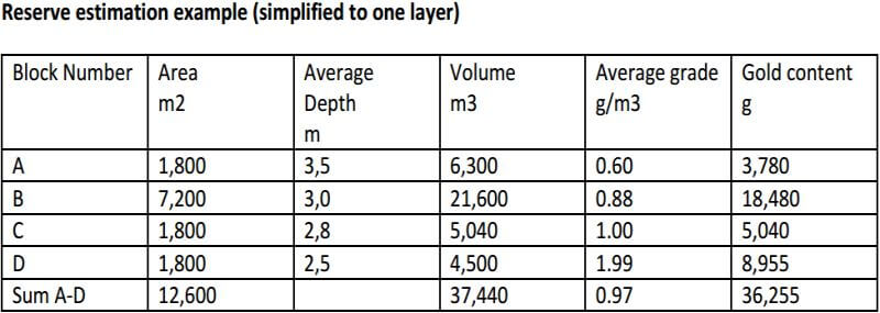
Reserve estimation example (simplified to one layer)
