Origin of Glaciers
In temperate and cold climates, and even in tropical countries, where there are very high mountains, the wastage of the snow by melting and evaporation may be less than the snowfall on the tops of the mountains; the snow, therefore, accumulates continually. In cold climates, like that of Greenland, snow accumulates even at ordinary levels, so that the whole of Greenland, except for a fringe of sea coast, is permanently covered. This accumulated snow slowly changes to ice by growth of the larger crystals at the expense of the smaller.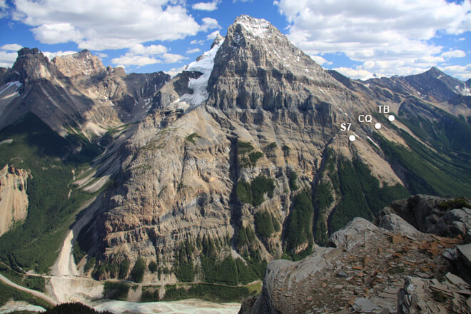
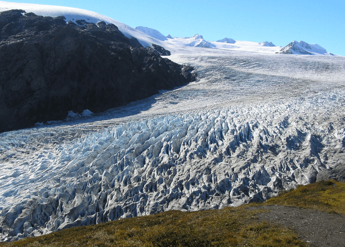
Ice that is formed in this way on the tops of mountains moves slowly down as glaciers. Where a more level country in a very cold climate is covered with an ice-cap, the ice moves forward. The condition of motion in both cases is that the upper surface of the ice shall have a slope downwards; this is provided for in the case of mountains, by the sloping sides. Ice-caps that cover a relatively flat country become thicker at some central area, where the snow accumulates faster, and this gives an upper surface sloping from a thick part outward; this slope makes it possible for an ice-cap to move forward over ground that is comparatively level. The Greenland ice-cap is probably between 5,000 and 10,000 feet thick at the center. The thickness of mountain glaciers in countries like British Columbia is often several hundred feet.
https://www.youtube.com/watch?v=pDAjVbSLfoM
Motion of Glaciers
The ice of a mountain glacier moves slowly down the mountain side, often in a valley, which it follows very much as a viscous liquid would, narrowing and widening and changing its direction, with the changes in the valley. The ice changes its shape to fit the changes in its bed, induced probably, by the melting of the ice-crystals by pressure, and followed by freezing, when the pressure is relieved by a slight movement of the water. It is a well-known fact that ice at or near the melting point can be melted by pressure. The rate of motion varies from 2 or 3 inches to as much as 60 feet a day.
The front end of a glacier is at a point where the ice melts as fast as it reaches that place; but the end may recede or advance according to temperature and other circumstances.
Work of Glaciers
(1) EROSION: The ice encloses boulders, pebbles, and other loose material, and carries them along with it in its descent.
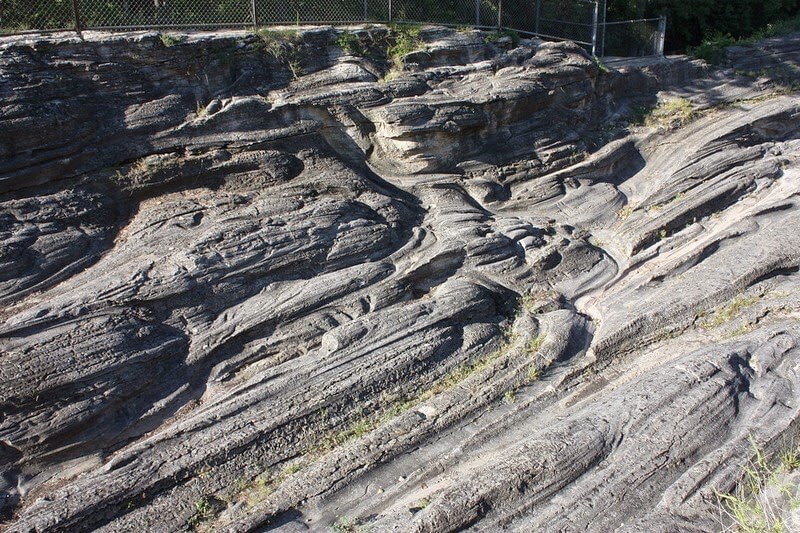
Its rock-shod bottom grinds and grooves the rocks beneath; these grinding tools are further assisted by pieces of rock broken off by the ice in its advance. Thus the valley is deepened and its V shape changed to U.
Rough country is planed down smooth, sharp rocks are rounded, and the tendency, as in the case of rivers, is to carry loose material to lower levels, and to make more loose material. But when the ice moves across a flat area, it does not necessarily push the covering ahead of it; it may even ride over vegetation without destroying it.
(2) Transportation: Large amounts of material are moved by glaciers. In addition to the boulders, pebbles, and silt picked up from the bottom, the top of the glacier carries a load of rocks that have fallen from cliffs, and of dust and sand blown upon it by winds.
(3) DEPOSITION: As the ice melts at the end of the glacier, its load is deposited; it is thus that the terminal moraine is built up. Along the sides of the glacier are ridges of boulders, etc., carried down by the edges of the ice. These ridges are called lateral moraines. Moraines are sometimes 1000 to 2000 feet high. When a glacier melts back a long distance, it leaves its load as an irregular heap, a ground moraine. Some glaciers form streams, which flow considerable distances under the ice and build up long ridges of gravel; when the glacier melts, these ridges appear as eskers.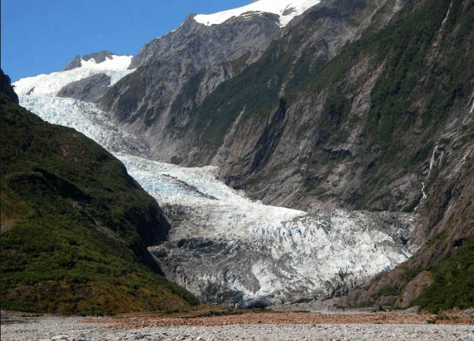
Deposits left by the ice differ from those made by rivers in that:
- (a) the glacial material is not sorted, boulders, pebbles, and silt being left in a mixed mass,
- (b) the stones are not rounded like river or wave-worn stones, but part of them are worn into angular shapes, and the surfaces are scratched and grooved;
- (c) the deposits are not stratified, except when carried and deposited by glacial streams; and
- (d) the finer material is rock-flour, composed of small grains of fresh rock, thus differing from river silt, which is formed by the decay of rock. Glacial deposits are often called glacial drift.
Work of Glacial Streams
Glacial streams carry the finer material, the rock-flour, and are often milky as they come from the glacier. This and coarser material are sometimes washed out and carried forward to form an outwash plain, which differs from moraines in being stratified and sorted; and differs from ordinary alluvial deposits in being composed of comparatively fresh pieces of rock, often including soft or easily weathered rocks that are not found in the older deposit.
The Glacial Period
When the surface of our country is examined, there is ample evidence that, at some time in the past, an ice-cap covered the northern part of the, continent, just as, at present, Greenland is covered with a great glacier. Rock surfaces are scratched and grooved; moraines are frequent; boulders are to be seen almost everywhere, many of these showing the characteristic grooves or scratches; and, in short, a large part of the covering of the country is glacial drift. In addition, the smooth, rounded surfaces of rocky hills and islets, and the U- shaped valleys, all these compose a convincing mass of evidence. There is evidence also of earlier glacial periods.
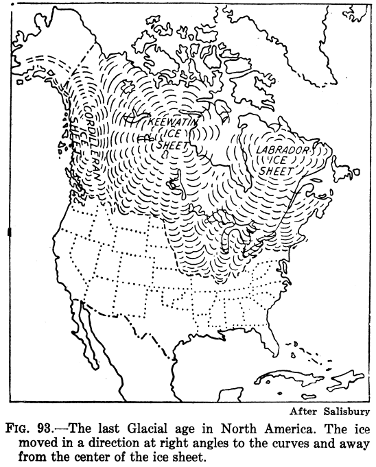
There were three great ice-caps in North America : one with its center in Labrador; a second covering the central part of Canada; and a third covering British Columbia, The eastern ice-cap extended as far south as Ohio and Illinois. There are ways of calculating roughly the time that has passed since the ice-cap finally melted. For example, calculating the time it has taken for Niagara Falls to wear back the six or seven miles from Queenston, where it began its life (when the ice- sheet retreated), to its present position, it seems that something like 30,000 years must have elapsed since the great eastern ice-cap melted away. Other estimates are as low as 15,000 years.
The principal work done by the ice in the glacial period was the removal of the loose material, and the smoothing of the rocky surface. It is thought that the ice-action is not accountable for any great lowering of the level of the rocky surface.
Practical Results
The practical results so far as prospecting is concerned are:
- (a) The uncovering of a great deal of rocky surface.
- (b) The transportation of material in a general southerly direction.
The glacial grooves are guides to the actual direction in any locality. Their direction varies, even within short distances; but their general trend in any district is a fairly definite indication. Another result is the occurrence of boulders formed of a kind of rock that is found in place only in a certain direction from the position of the boulders; that direction is the direction in which the glacier moved. Prospectors sometimes find valuable minerals in the glacial debris. It is often possible to follow this “float” back to its origin, and the glacial grooves show the direction in which to prospect. If the float is not much worn, the distance it has traveled is not likely to be very great.
- (c) The deposition of boulders, gravel, and boulder clay, composed of material different from the rock underneath.
